The Laws of Horizontality and Superposition (or, which layer is oldest?)
Law of Horizontality
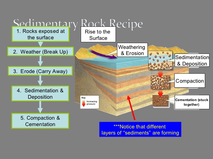
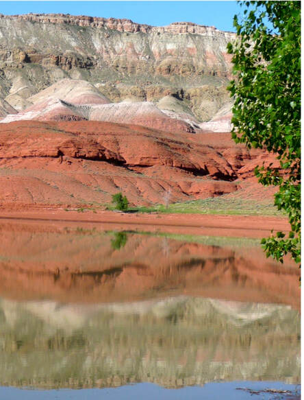
As sediments deposit, they deposit in horizontal layers. This is known as the Law of Horizontality. The oldest layers are at the bottom and the newest layers are at the top. If you were to dig down through the layers, you would be going back in geologic time.
Law of Superposition
|
|
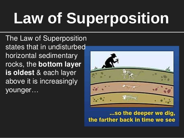
Law of Superposition - which states that, in any undisturbed sequence of rocks deposited in layers, the youngest layer is on top and the oldest on bottom, each layer being younger than the one beneath it and older than the one above it.
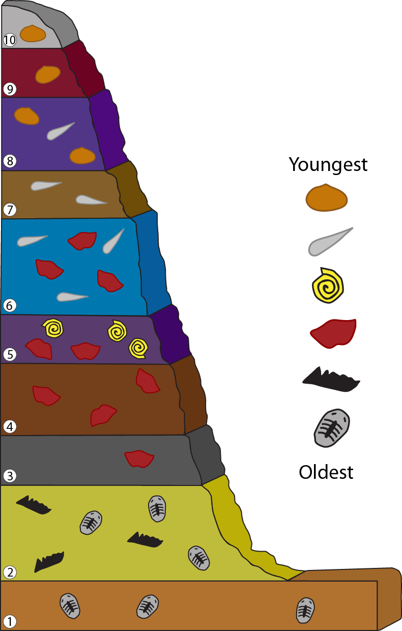
Because we find fossils in these sediments, we can date when those organisms lived by which layer of sediment they are found in. Look at the image above and to the right. Notice how some fossils can be found in many layers, while others can only be found in some layers. This tells us the periods of geologic time during which these organisms lived.
Because we find fossils in these sediments, we can date when those organisms lived by which layer of sediment they are found in. Look at the image above and to the right. Notice how some fossils can be found in many layers, while others can only be found in some layers. This tells us the periods of geologic time during which these organisms lived.
How does a laundry basket help explain these laws?

|
Imagine the whole family is putting their laundry in the basket all week, starting on Sunday and continuing through Saturday. Saturday is laundry day. Which layer has the clothes you wore on Monday? Which layer has the clothes you wore on Saturday?
Now, as clothes are piled on top, which layers are most "compacted?" What if you wanted to wear the pants you put in the basket on Monday? You'd have to disturb the laundry basket to get to that layer. Can you think of events that might "disturb" rock layers? |
|
|
A nice website that explains this can be found by clicking on the image to the left. On the left is a mini-lecture on the Law of Superposition called "Paintbrush Geology". You are not required to watch this, however.
|
Evidence for dinosaur extinction 65 mya is in the rocks!
|
Evidence shows that a meteor about the size of Manhattan struck the Earth ~ 65 million years ago, with the impact energy of about 2 million thermonuclear bombs. This sent clouds of dust into the atmosphere that ultimately settled (according to the Law of Horizontality) in a thin layer that is found literally around the world that dates back 65 million years. This layer contained higher than normal amounts of the element iridium, which is found in meteors. No large dinosaur fossils are found in layers higher than this thin layer, which is now called the K-T boundary. The question was, "where did the meteor strike?" No impact crater of the size projected was obvious, until.....
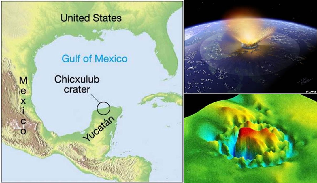
Evidence for the location of where the meteor struck was found near Mexico, where "tektites" were found in abundance. These tektites are igneous glasses (just like obsidian is an igneous glass) formed when a meteor strikes with such force that the quartz rock melts, sprays into the atmosphere and cools into glass particles (igneous rock) that rain back down to earth and add a new layer to the sediments.
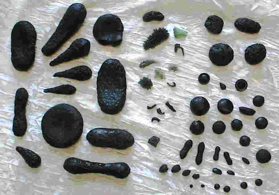
Samples of tektites near meteor impact site
|
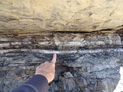
Thin layer of iridium-rich deposits shown in this sedimentary rock is the boundary line above which dinosaur fossils are no longer found.
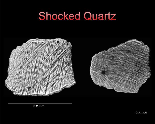
Quartz that did not melt, but was subjected to intense pressure changed into what is called "shocked quartz", which was also found nearby. The pressure of the meteor impact caused the line patterns in the quartz you see in the image below. This is another form of metamorphism (no melting!) known as "shock metamorphism". [Remember that you learned about contact, regional and dynamic metamorphism earlier]
|
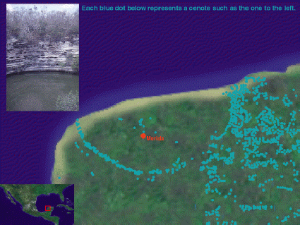
Sinkhole or cenote map on Yucatan peninsula
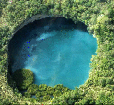
Aerial view of cenote (or sinkhole)
|
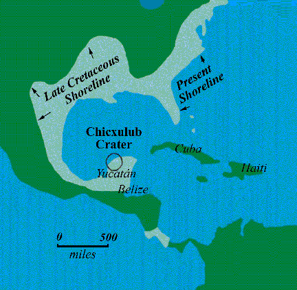
At the time that the meteor struck, the earth's oceans were much higher, so the shoreline was different from today. The period called "Late Cretaceous" on the image on the left shows where the shoreline was at the time the meteor struck.
Remember continental drift? Here's a really wild interactive that lets you look at the earth during different time periods. If you go to the period where the meteor struck, you can rotate the earth and see that India is still south of the equator! And if you go back 90 million years, you'll see that the U.S. had an inland ocean. You can see that the meteor struck where there was once only ocean. The impact created a 1 km high "mega" tsunami that swept into North America and deposited sediments as far north as where Northern New Mexico and Colorado are located today. Talk about weathering and erosion! Once scientists found evidence of the meteor in the rocks, they began to look more closely for the crater. Evidence was found serendipitously (a happy accident) by a geologist looking for possible places for his company to drill for oil. He found gravitational abnormalities that showed a perfect circle. Otherwise, the crater is no longer visible, covered in 1 km of accumulated sediments since the impact. The gray part of the image below shows the Yucatan peninsula. The white dots are sinkholes (or cenotes), which are thought to form from the wall of the old crater collapsing (weathering and eroding). These cenotes may be seen on the map on the left. 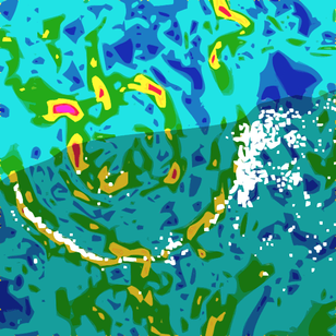
Gravitational map that shows semi-circle on Yucatan peninsula. White dots show where the sinkholes are.
|
